Historic shipwreck destroyed by coastal erosion (Sylt, Germany)

In October 2016, a Dutch-built shipwreck of ca. 1690 at Sylt’s southern tip – Hörnum Odde – was reported to the State Archaeology Department of Schleswig-Holstein (ALSH). The substantial hull remains came to light as a result of strong tidal currents and an underlying erosion process. The site was located at the outer extent of the intertidal zone and only accessible at low tide and offshore winds. Thus, the location of the site imposed a special challenge, as its location in the surf zone neither allowed for an underwater survey, nor a proper terrestrial excavation. Therefore, the recording method had to be extremely time-efficient in order to gather as much data as possible within a very short time-frame. By New Year, the entire wrecksite was reported missing. It was reclaimed by the sea as a result of coastal erosion and winter storms.
Further reading:
Zwick, D., A late 17th-century ‘Double Dutch’ construction in the North Frisian Wadden Sea: The case of the Hörnum Odde wreck on the Island of Sylt, Germany. In G. Boetto, P. Pomey, P. Poveda (eds.), Open Sea … Closed Sea. Local and inter-regional traditions in shipbuilding. (= Proceedings of the 15th International Symposium on Boat & Ship Archaeology, Marseille 22-27 October 2018). Paris 2021, pp. 203-209.

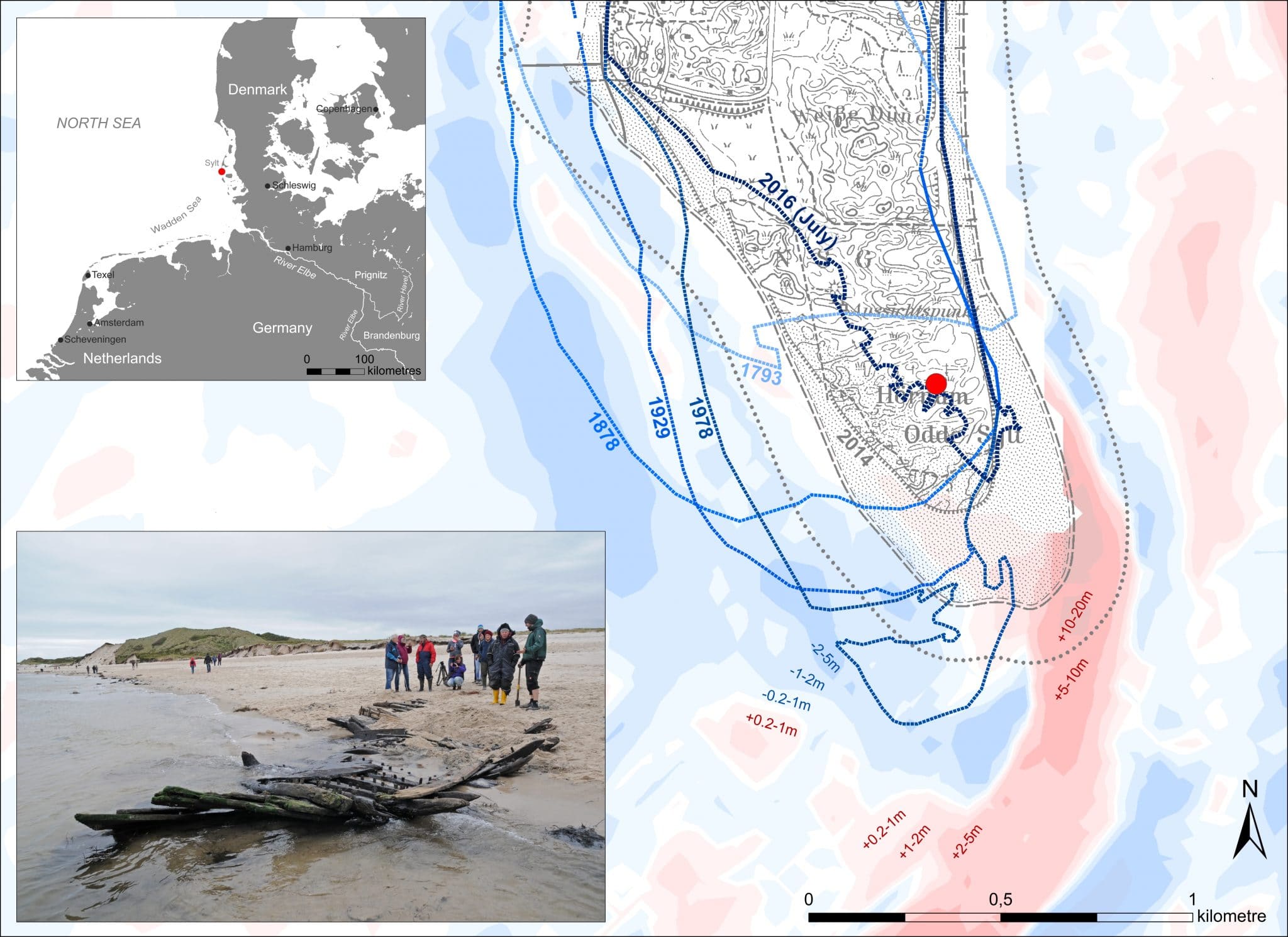
The find location of the Hörnum Odde wreck (red dot) in the regional context (top left) and georeferenced in the digital topographic map of 2014 (background). As the historical coastline of 1793 (mean sea water level) and the dune edges of 1878, 1929, 1978, 2014 and 2016 indicate, Sylt’s Odde has been subject to erosion along its western shore and sand aggradation at its southern spit for centuries. A shift towards a more southeasterly deposition of sediments in more recent times is reflected by geomorphological data, as indicated by the different shades of blue (=erosion) and red (=sedimentation) for the period of 1982-2012 with the total values of depth differences. This underlying process explains the rapid land loss at the wrecksite itself. While the dune edge has advanced closely above the wrecksite by July 2016, it has moved considerably further inland at the discovery of the wreck in early October of the same year, when the photo (bottom left) was taken (Graph & ArcGIS: Daniel Zwick / Photo: ALSH / DTK25-map: LKN-SH / geomorpological data: GDI-BSH).


